

Data Analysis Courses


- AIA CES
- AICP CM

- AIA CES
- AICP CM


- AICP CM


- AICP CM
- CNU-A
- SACPLAN CPD
Top Data Analysis Instructors


Master Urban Planning Skills With A Planetizen Courses Subscription.
Try Free CoursesHigh quality video lessons developed by experts.
Complete course work to receive a certificate from Planetizen.
Test your comprehension with course quizzes.
Access reading lists, articles, and other materials prepared by instructors.
All Data Analysis Courses
Introduction to GIS, Part 2
Take the next step into the world of Geographic Information Systems (GIS) and ArcGIS Pro with an overview of navigation, map projections, and essential map design principles.
Navigating the Ethical Landscape for AI in Urban Planning
Uncover some of the largest ethical issues related to using AI in urban planning and the steps cities around the world are taking to ensure fairness, honesty, and accountability as this revolutionary technology becomes more embedded in the modern world.
Demystifying AI: Terminology, Tools, and Techniques for Urban Planners
Understanding the basics of artificial intelligence, or AI, is increasingly important for urban planners. Learn the capabilities, limitations, and language of emerging technologies that utilize AI methods.
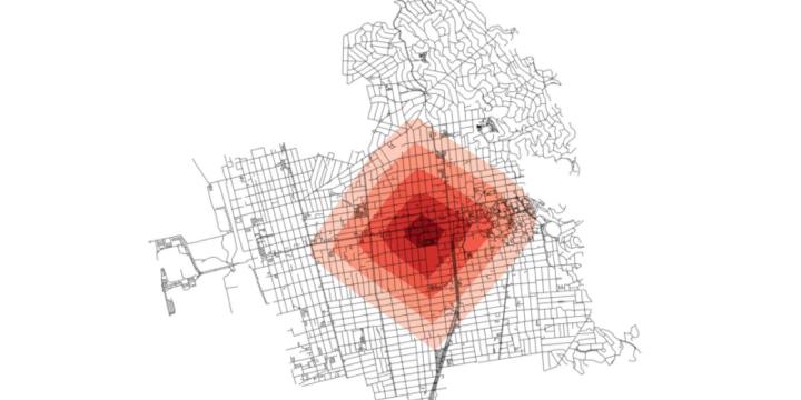
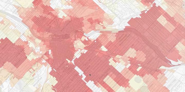
Crime and Urban Planning in the United States
The spatial patterns and environmental characteristics of urban crime offer planners an opportunity to contribute to building crime-resilient communities.
Solving Coverage and Location-Allocation Problems
Location-allocation problems involve locating supply sites and simultaneously allocating demand to those sites so the entire system is optimized. With this course, you will learn the basic principles of the coverage and location-allocation problems and be able to solve them using LINGO software and map the results in QGIS.
Planning Commissioner Training
The new "Planning Commissioner Training" series offers citizen planners a chance to learn the tools to make a positive impact in their communities (available as a separate subscription).
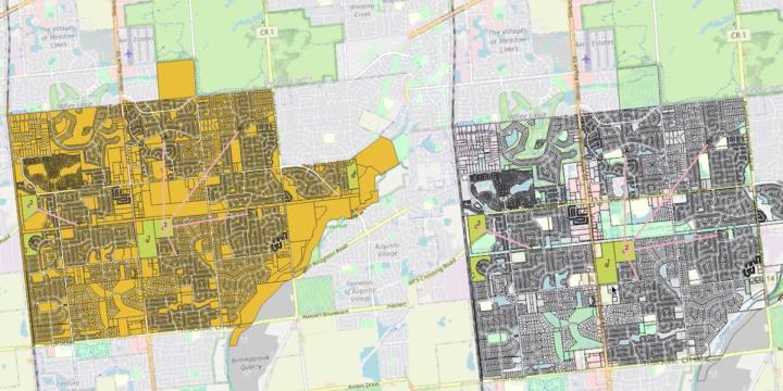
Suitability Analysis and Linear Optimization: Siting a New Transit Line
This course applies suitability analysis techniques and least-cost path analysis—which optimizes routes on linear features—to planning for and siting a new transit line.
Location Optimization
This course introduces the basic principles of location optimization models and provides a hands-on tutorial on point-based location optimization using QGIS and LINGO.
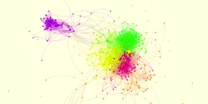
Introduction to Urban Informatics
This course discusses how the field of urban informatics works. You will also learn about the technologies and concepts influencing Urban Informatics, including "Big Data," machine learning, visualization, and data-driven decision making.
Introduction to Smart Cities
This course explores the characteristics and the challenges of smart cities, as well as the potential opportunities for a smart cities approach within the urban design and urban planning fields. This course also discusses the drivers and the essential technologies in a smart city.
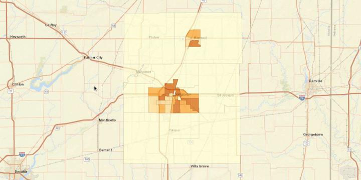
Measuring Neighborhood Segregation and Diversity
This course reviews the various ways to measure both segregation and diversity at the neighborhood scale.
United States Census 2020: Using FactFinder and the American Community Survey
Learn how to use Census.gov and American FactFinder websites, which are the principal portals to Census Bureau data products and maps.
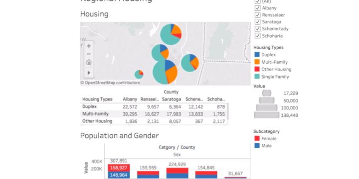
Tableau for Planners 3: Dashboards
This course will expand on the Tableau for Planners: Introduction and Worksheets. Students will have prior experience will building basic tables and will start to use Tableau to build multi-worksheet dashboards with interactive controls like filtering. Students will also learn how to make the data used in their visualization accessible to the public. At the end of the course, we will demonstrate how to publish the work to Tableau Public and embed dashboards on websites and in social media.
Tableau for Planners 2: Worksheets
This course will expand on the Tableau for Planners: Introduction course. This course continues to train the planner on how to build effective worksheets for planners. This course will introduce general principles of data visualization and orient the user with the Tableau platform, with a primary focus on Tableau Public, a free version of Tableau's desktop software.
Tableau for Planners: Introduction
This course will introduce general principles of data visualization and orient the user with the Tableau platform. Learn how to connect to a data set in Microsoft Excel, understand general principles of a relational database, and start building basic worksheets and dashboards.
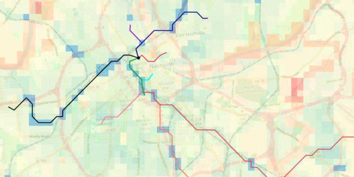
Python Street Network Analysis
In this course we will learn how to use Python to conduct street network analysis with the OSMnx package.
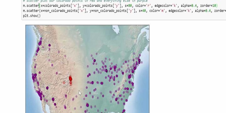
Python Geospatial Analysis and Mapping
Learn how to use Python to work with urban spatial data.
Python Data Analysis and Visualization
In this course we will learn how to use Python to conduct basic data analyses and create attractive visualizations.
Coding for Planners: Up and Running with Python
Python is one of the world’s most popular programming languages, particularly among beginners, thanks to its clear and straightforward syntax. It is also one of the most widely used languages for data science.
Regional Planning Workflows in the UrbanSim Cloud Platform
This course reviews the basic land use forecasting workflows that can be completed using the UrbanSim Cloud Platform, as illustrated by a set of case studies.
Economic Impact Analysis in Land Use Planning
This course examines how input-output models contribute to economic impact analyses and presents examples of how economic impact analysis can be applied in a wide range of planning projects.