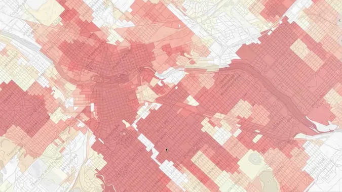
map created in Urbansim cloud platform for urban planning course

Regional Planning Workflows in the UrbanSim Cloud Platform

This course reviews the basic land use forecasting workflows that can be completed using the UrbanSim Cloud Platform, as illustrated by a set of case studies.

  • Preview Course PREVIEW
Watch this course for free GET STARTED

Course Info

  • Duration 7 video lessons (57 Mins)
  • Published Published
    2017
  • 4.29
Play Video

Preview Course Preview Course

Browse Course Chapters

  • Chapter Locked
    1.
    Introduction
    Chapter Duration 2 mins
  • Chapter Locked
    2.
    Initial Simulation and View Indicators
    Chapter Duration 8 mins
  • Chapter Locked
    3.
    Alternative Land Use Regulations
    Chapter Duration 10 mins
  • Chapter Locked
    4.
    New Development Clusters
    Chapter Duration 8 mins
  • Chapter Locked
    5.
    Alternative Transportation Infrastructure
    Chapter Duration 9 mins
  • Chapter Locked
    6.
    Alternative Macro Assumptions
    Chapter Duration 6 mins
  • Chapter Locked
    7.
    Incorporating Local Feedback
    Chapter Duration 10 mins

Course Description

At the end of this course, participants will understand the basic land use forecasting workflows that can be completed using the UrbanSim Cloud Platform, as illustrated by a set of case studies. In this course, we use the platform to complete forecast-related workflows related to tracking and inserting development projects, inputting development constraint information, composing scenarios, evaluating simulation results, and comparing differences between scenarios and over time. Examples in this course will be drawn from the Minneapolis-St. Paul region, and participants are encouraged to follow along with a trial instance of the platform. 

Pre-requisites: Introduction to the UrbanSim Cloud Platform Course.

Learn these skills

  • Data Analysis
  • Land Use
  • Technology

Meet Your Instructor

Sam Blanchard

Sam Blanchard

Sam Blanchard is a Data Scientist at UrbanSim Inc. where he specializes in land use modeling, transportation planning, and network and geospatial data analysis.

Meet Instructor

Master Urban Planning Skills With A Planetizen Courses Subscription.

Try Free Courses
Computer

High quality video lessons developed by experts.

Analytics

Complete course work to receive a certificate from Planetizen.

Certificate

Test your comprehension with course quizzes.

Cloud

Access reading lists, articles, and other materials prepared by instructors.