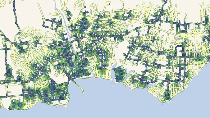
map showing walkability created in arcmap

GIS Walkability Modeling

As the field of planning continues to trend toward multi-modal, sustainable transportation practices, tools to model or analyze the walkability of a given area have grown in number and complexity. In this course, students will learn how to apply ArcMap and the Spatial Analyst extension to model walkability. The course assumes students have a working knowledge of GIS and basic familiarity with Spatial Analyst.

  • Preview Course PREVIEW

Course Info

  • Duration 7 video lessons (46 Mins)
  • Published Published
    2012
  • 4.28
Play Video

Preview Course Preview Course

Browse Course Chapters

  • Chapter Locked
    1.
    Introduction
    Chapter Duration 1 min
  • Chapter Locked
    2.
    Existing Walkability Tools & Game Plan
    Chapter Duration 4 mins
  • Chapter Locked
    3.
    Preparing Datasets 1: Assigning Values
    Chapter Duration 21 mins
  • Chapter Locked
    4.
    Preparing Datasets 2: Creating Friction Grids
    Chapter Duration 5 mins
  • Chapter Locked
    5.
    Running A Walkshed Analysis
    Chapter Duration 4 mins
  • Chapter Locked
    6.
    Post-processing Results
    Chapter Duration 9 mins
  • Chapter Locked
    7.
    Summary
    Chapter Duration 1 min

Course Description

As the field of planning continues to trend toward multi-modal, sustainable transportation practices, tools to model or analyze the walkability of a given area have grown in number and complexity. In this course, students will learn how to apply ArcMap and the Spatial Analyst extension to model walkability. The course assumes students have a working knowledge of GIS and basic familiarity with Spatial Analyst.

Learn these skills

  • Data Visualization
  • GIS
  • Mapping
  • Pedestrian Planning
  • Technology
  • Urban Design
  • Walkability
  • WalkShed
  • ArcGIS

SACPLAN CPD

This course is approved for 1 SACPLAN CPD point.

Meet Your Instructor

Steph A. Nelson

Steph A. Nelson

Steph A. Nelson has utilized GIS in a variety of settings including working as a GIS Research Associate with the U Penn Cartographic Modeling Lab, a GIS Analyst/Intern with Interface Studios LLC, an Associate Analyst with the Association of Monterey Bay Area Governments and most recently as a Senior Analyst with the San Francisco Municipal Transportation Agency’s SFpark program.

Meet Instructor

Master Urban Planning Skills With A Planetizen Courses Subscription.

Try Free Courses
Computer

High quality video lessons developed by experts.

Analytics

Complete course work to receive a certificate from Planetizen.

Certificate

Test your comprehension with course quizzes.

Cloud

Access reading lists, articles, and other materials prepared by instructors.