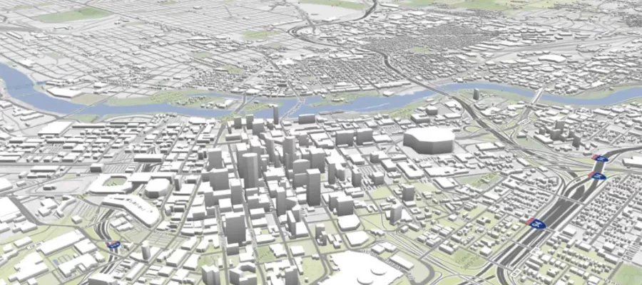
3-d map created in urbansim cloud platform for urban planning course

Introduction to the UrbanSim Cloud Platform

At the end of this course, participants will be acquainted with the UrbanSim forecasting methodology, understanding the features available in the UrbanSim Cloud Platform and the basics of an UrbanSim model at the Census block level.

  • Preview Course PREVIEW
Watch this course for free GET STARTED

Course Info

  • Duration 10 video lessons (51 Mins)
  • Published Published
    2017
  • Trending Trending
  • 4.00
Play Video

Preview Course Preview Course

Browse Course Chapters

  • Chapter Locked
    1.
    Introduction
    Chapter Duration 2 mins
  • Chapter Locked
    2.
    Land Use Forecasting and UrbanSim
    Chapter Duration 4 mins
  • Chapter Locked
    3.
    UrbanSim Methodology
    Chapter Duration 5 mins
  • Chapter Locked
    4.
    UrbanSim Case Studies
    Chapter Duration 3 mins
  • Chapter Locked
    5.
    UrbanSim Model Templates
    Chapter Duration 6 mins
  • Chapter Locked
    6.
    UrbanSim Cloud Platform Overview
    Chapter Duration 3 mins
  • Chapter Locked
    7.
    Running Your First Simulation
    Chapter Duration 4 mins
  • Chapter Locked
    8.
    Uploading Data
    Chapter Duration 3 mins
  • Chapter Locked
    9.
    Development Projects, Development Constraints, and Model Adjustments
    Chapter Duration 10 mins
  • Chapter Locked
    10.
    Composing Scenarios and Running Simulations
    Chapter Duration 5 mins

Course Description

The UrbanSim Cloud Platform provides pre-built UrbanSim models and supporting tools for crafting and evaluating a socioeconomic forecast for a small geographic area.

At the end of this course, participants will be acquainted with the UrbanSim forecasting methodology,understanding the features available in the UrbanSim Cloud Platform and the basics of an UrbanSim model at the Census block level.

We will develop familiarity with the cloud platform's user interface and explore how to use the platform to track a city's development pipeline, edit development and zoning constraints, and refine a forecast.  We will use the platform to compose scenarios, launch UrbanSim simulations, and visualize model outputs using the 3D mapping interface.

Learn these skills

  • 3D Modeling
  • Data Visualization
  • Mapping
  • Modeling & Simulation
  • Site Planning
  • Technology

SACPLAN CPD

This course is approved for 1 SACPLAN CPD point.

Meet Your Instructor

Sam Blanchard

Sam Blanchard

Sam Blanchard is a Data Scientist at UrbanSim Inc. where he specializes in land use modeling, transportation planning, and network and geospatial data analysis.

Meet Instructor

Master Urban Planning Skills With A Planetizen Courses Subscription.

Try Free Courses
Computer

High quality video lessons developed by experts.

Analytics

Complete course work to receive a certificate from Planetizen.

Certificate

Test your comprehension with course quizzes.

Cloud

Access reading lists, articles, and other materials prepared by instructors.