Course Info
7 video lessons (59 Mins)
Published
2018-
4.08
Preview Course
Browse Course Chapters
-
1.Introduction
5 mins
-
2.Neighborhood Delineation Coverage
6 mins
-
3.Pedestrian Sheds
9 mins
-
4.Final Neighborhood Delineation
11 mins
-
5.Visualize Connectedness Around Neighborhood Centers
9 mins
-
6.Design for Center Connectivity
7 mins
-
7.Neighborhood Center Design Example
9 mins
Course Description
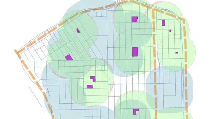
In this course, the third course in the "Urban Design for Planners" track, course instructor Emily Talen, PhD, FAICP, provides step-by-step instructions on how to delineate a set of neighborhoods and neighborhood centers for a given area using QGIS, SketchUp, and Inkscape. While providing training on the technical aspects of urban design software required for these tasks, Dr. Talen invites students to consider how urban design can be used to enhance our understanding of neighborhoods and centers.
Talen, an expert on neighborhoods, discusses historical conceptions of neighborhoods as well as an updated understanding of the neighborhood that includes green infrastructure and community centers. Additionally, Talen invites students to draw connections between the spatial unit known as the neighborhood and the more broad organization of cities.
Students will spend time in this course working with QGIS and other urban design software tools to consider a multitude of approaches to delineating neighborhoods based on different sets of data and multiple perspectives. Students will also map five-minute walking radii around neighborhood centers and identify routes in the area.
With a layered understanding of the various approaches to delineating neighborhoods in place, the course concludes with a conversation about public engagement and the importance of engaging communities while implementing design strategies that improve the connections and designs of neighborhood centers.
Learn these skills
- 3D Modeling
- Data Visualization
- GIS
- Mapping
- Modeling & Simulation
- Technology
- Urban Design
- QGIS
AICP CM
This course is approved for 1 AICP CM credit.
AIA CES
This is 1 LU.CNU-A
SACPLAN CPD
This course is approved for 1 SACPLAN CPD point.


